
Earthquake Early Warning - Blog
2023-09-14: What to do when in a wheelchair during an earthquake
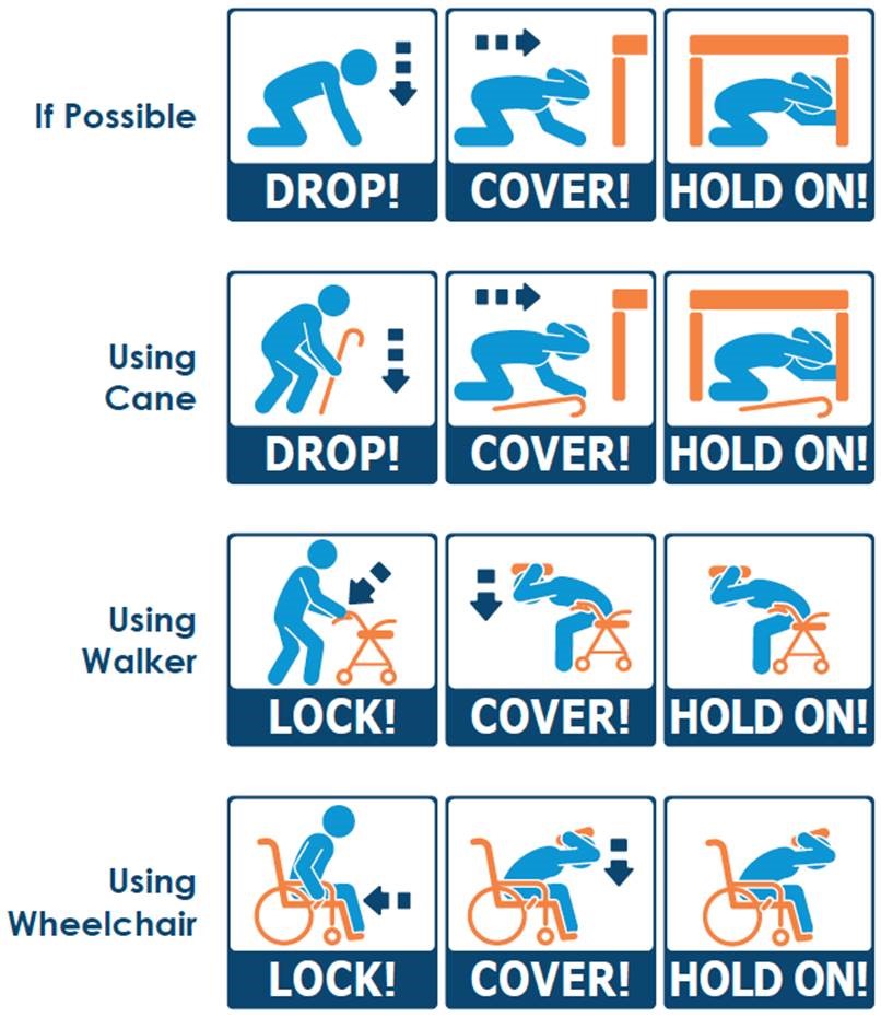
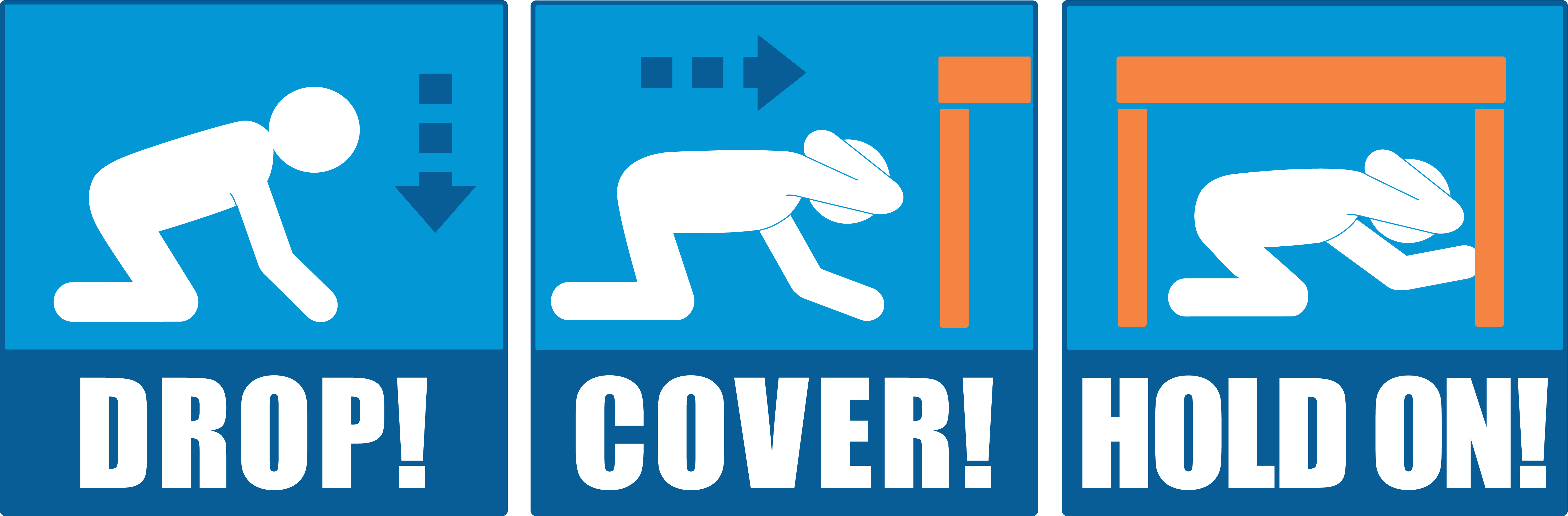
People with limited physical ability may have trouble responding to earthquake shaking, or to an Earthquake Early Warning alert, with the recommended “Drop, Cover, and Hold on” actions. The graphics, above, depict some alternative actions to take. If you are in a wheelchair or using a walker when you feel shaking or receive an alert, turn so that you will be facing away from windows and other hazards, then Lock the wheels, Cover your head and neck with your arms, if possible, and Hold on. It is advisable to practise these actions in advance, so that they become instinctive. Register for this year's practice drill at: www.ShakeOutBC.ca (BC), www.grandesecousse.org (Quebec and eastern Ontario; in French only), and www.shakeout.org/yukon/ (Yukon).
Finally, it is best to “secure your space” beforehand (see blog post from 2023-08-10).
2023-09-07: What to do when driving during an earthquake
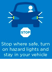
If you experience an earthquake whilst driving, it can seem as though there is something wrong with your car. Shaking trees, powerlines, and lamp standards are good indicators that you might be experiencing an earthquake. You may also receive an Earthquake Early Warning alert, before feeling any shaking. The best response in these situations is to Stop, Brake, and Stay. Slow down and pull over somewhere safe, avoiding overpasses, powerlines, bridges, and old (especially brick or stone) buildings. Turn off the engine and secure the handbrake. Stay in the car until the shaking stops. If a power line falls onto your vehicle, remain inside until a trained person can remove it. If you are trapped in your vehicle for any reason, turn on your emergency flashers.
After the shaking stops, listen to the radio and heed directions from officials. Keep emergency response routes clear and be aware of potential hazards, such as downed powerlines, damaged roadways, and other obstructions. If you are in a potential tsunami inundation zone, move to higher ground on foot and stay there until directed otherwise by authorities.
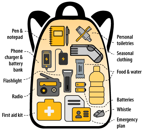
It is a good idea to keep a 'grab'n'go' emergency kit in your vehicle; advice on what to put into such a kit can be found here: Get Prepared.
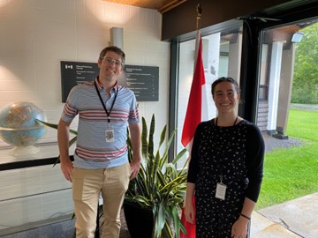
UBC Co-op student assists with EEW's Indigenous engagement efforts
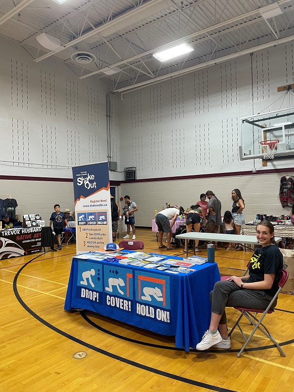
University of British Columbia co–op student, Marleigh MacLaren has just completed a productive work-term, as NRCan's Communications Assistant for the Earthquake Early Warning programme. She has designed a new display for the Haida Gwaii museum, which will include regionally-specific information on earthquakes, tsunami, and earthquake early warning. She also contributed to preparing engagement materials and activities, including several as part of a large public education campaign on EEW; the project is funded by NRCan and is being led by BC's Ministry of Emergency Management and Climate Readiness. Finally, Marleigh supported ShakeOutBC activities this summer, including hosting a booth at the annual Yellow Wolf Pow Wow held by Tsartlip First Nation in July.
2023-08-25: Co-op student helps assess the EEW system
As the Earthquake Early Warning (EEW) System is developed and NRCan's EEW data center processes earthquakes in "test" mode, the system is continually being assessed. University of Waterloo cooperative student, Bianca Angheluta, worked with supervisor Stephen Crane to develop assessment software, which automatically produces "EEW System Functionality Reports".
These reports provide a summary of the earthquakes the EEW system processed or omitted. The reports provide detailed information on each event, including the stations which contributed to the analysis, the corresponding seismograms, and the accuracy of the events' magnitude, epicenter location, and origin time. In other words, the reports show how well the EEW system is performing and are regularly reviewed by seismologists.
2023-08-21: What to do when outside during an earthquake
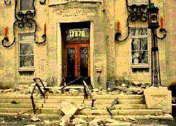
If you are outside and experience shaking (or receive an Earthquake Early Warning alert), it is best to stay outside, move to an area clear of hazards, then crouch down, and cover your head and neck with your arms. It is advisable to stay away from buildings (especially old, brick or stone structures), large objects, utility wires, and other hazards. The area near the exterior walls of a building can be dangerous, as windows, facades, and architectural details often topple.
Register for this year's ShakeOut earthquake drill in: BC at ShakeOutBC, Quebec at GrandeSecousse (in French only), Yukon at ShakeOut Yukon, and elsewhere at ShakeOut.
2023-08-10: What to do when inside your home or at work during an earthquake
When you are inside and feel shaking or receive an Earthquake Early Warning alert, your instinct may be to run outside. This is one of the most dangerous things you can do. Generally, the best response is to Drop, Cover, and Hold on. Drop to the ground before the shaking causes you to fall. Take cover under a desk, table, or other piece of furniture to protect yourself from falling objects (light fixtures, debris, items from shelves or cupboards). And, hold onto that furniture with one hand, whilst protecting your head and neck with the other. If there is no furniture for shelter in the room you're in, move to an interior corner or wall (away from windows and other hazards), crouch down, and cover your head and neck with your arms.
To reduce the chance of injury, it is advisable to “secure your space”, at home and at work. Attach tall and/or heavy furniture and appliances to wall–studs, move heavy items to lower shelves or cupboards, remove pictures from over the heads of beds or places where people sit, and strap your water–heater to the building. For more information on how to prepare your home for earthquakes, visit: Public Safety Canada and Earthquakes Canada
Finally, by practising the “Drop, Cover, Hold on” response to earthquakes, you create muscle memory, increasing the likelihood you will take these protective measures in an earthquake. Register for this year's practice drill at: ShakeOutBC or GrandeSecousse (in French).
2023-08-04: Camosun College co-op students help NRCan in the field
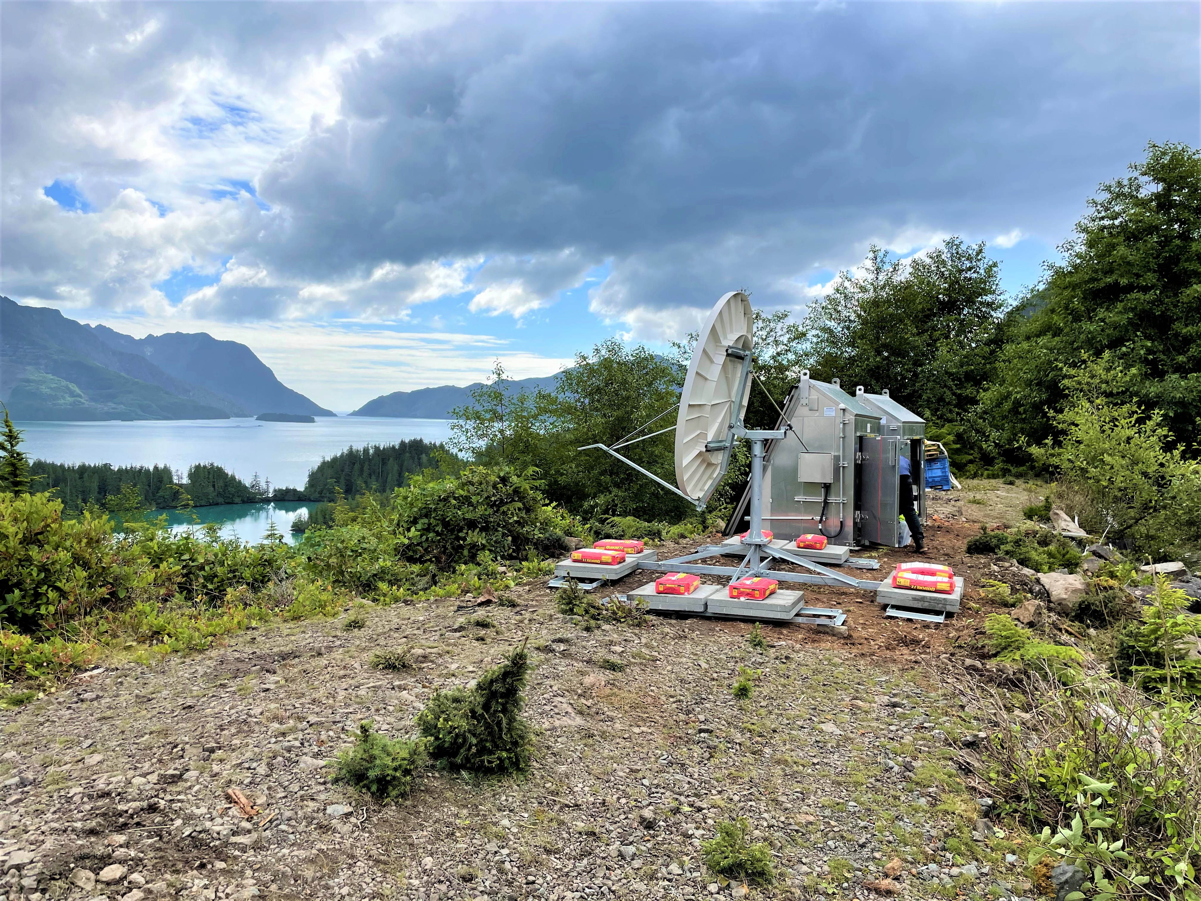
Camosun College students, Aaron Huinink and Tella Osler, recently returned from two weeks with NRCan's field crew on Haida Gwaii. The crew were installing several Earthquake Early Warning stations on the archipelago. Included in the crew's activities was the installation of complex infrastructure at a challenging site in Tasu Sound, shown above. Due to the remote nature of the site, the station is powered by solar panels, with back–up batteries, and data are sent to NRCan data centres via satellite.
2023-07-14: Less than one year to EEW
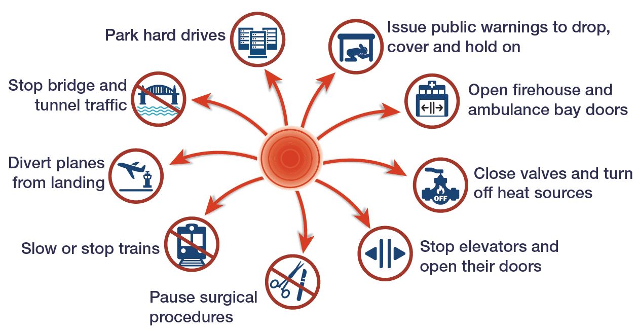
NRCan is now in the final year of development for the Earthquake Early Warning (EEW) System. Next spring, the EEW system will be on-line and able to send alerts to people, critical infrastructure operators (such as rail, energy, utilities, health, emergency response, and government), and industry. These EEW messages will announce that an earthquake has just been detected and strong shaking is imminent, providing people and systems valuable seconds to take protective actions. People will usually Drop, Cover, and Hold on (see ShakeOutBC for more information). Facilities that have automated EEW devices installed will be able to trigger safety measures, such as sound alarms, open doors, close valves, and secure machinery. These responses can reduce the impact of major earthquakes, including injuries, and help organizations return to normal operations more quickly.
2023-07-03: NRCan's EEW data centre processes its first earthquake
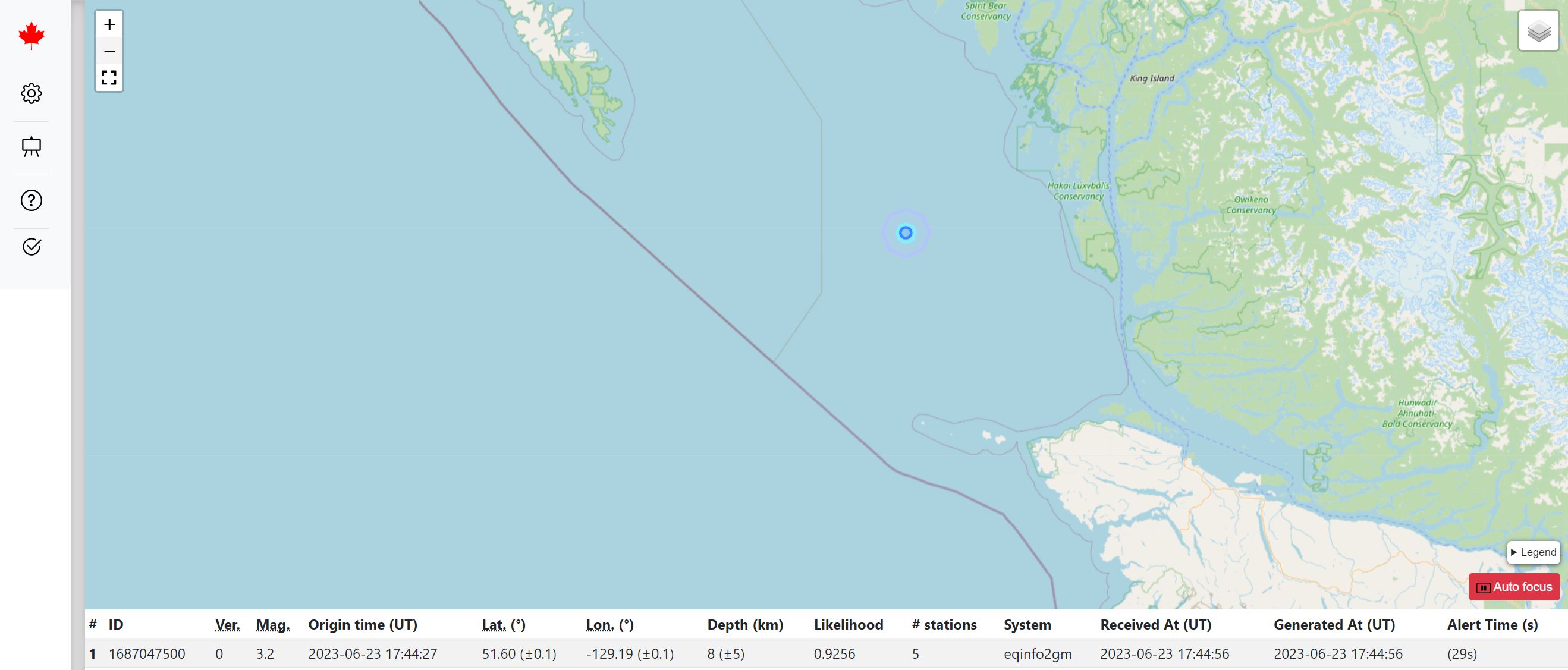
A datacentre near Ottawa, established for Natural Resources Canada's Earthquake Early Warning (EEW) system, is currently running in “test” mode while the remainder of the EEW system is being completed. The datacentre recently processed its first earthquake. The earthquake, which occurred on 18th June under the waters between Haida Gwaii and Vancouver Island, was relatively minor, at magnitude 3.2. As a result, the ground motions on land would have been too small to result in an alert.
Once the EEW system is launched in 2024, however, larger earthquakes with the potential to cause damage or injuries, will result in the data centre transmitting EEW alerts. These will be sent to automated systems, to trigger protective actions, and to the National Public Alerting System, to alert the public that strong shaking is imminent and they should protect themselves, usually to “drop, cover, and hold on”.